The sun is getting low. The yellow lichen atop this white granite boulder is blazing brilliantly in the orange twilight. A nice rock with good views of the Cordillera Blanca and the roaming, boulder-riddled foothills. Where do they all come from, the boulders? There are two rusted bolts drilled into the rock with their tops sheared off. Too bad. It’d be a nice top-rope climb. The northern face is smooth with a few indentations, the southern, weather-beaten and cracked. Ah well. Perhaps these broken anchors are a sign. Best to just sit here and take it all in.
The hostel below is kinda funky. I like it. It represents a very different dream V and I share from the one we are currently realizing – earthen buildings, gardens, chickens, sedentary. Some day perhaps, but not just yet. My wandering isn’t quite over.
The shadows are getting long now. The breeze is picking up. The sun on my back isn’t as warm as it was minutes before. The jagged peaks are now hiding behind the approaching clouds coming over the range. I take a moment to turn my attention inwards. My headache is gone. Not grumpy anymore… I think. I button up my shirt and walk back down to camp. Time to start dinner.
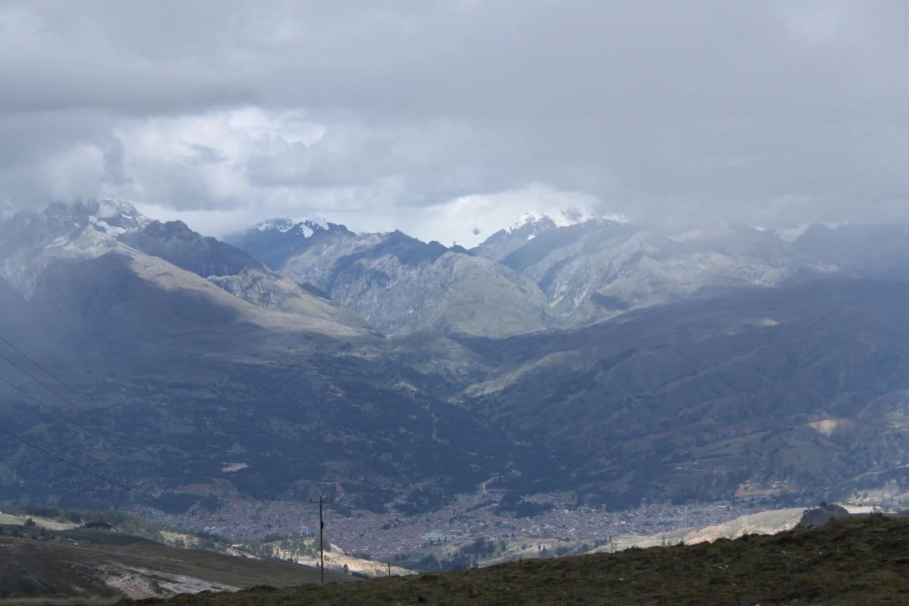
Huaraz below and the Cordillera Blanca. Photo by Nate
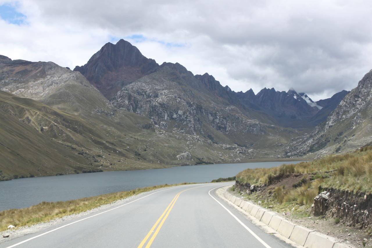
We entered the Peruvian Andes from the coastal desert by way of a canyon that reminds me of something out of Star Wars. I kept expecting to see Sand People and Jawas pop out from around the rocky, dusty cliffs. The road was long with more curves than strait stretches. It took us from sea level up to 4200 meters before dropping us down into a valley that is home to the city of Huaraz.
Huaraz is nothing to write home about, at least not in terms of architecture or charm. That being said, we found an excellent microbrewery (Sierra Andina) which offered a fine selection of ales, and we finally found the spare fuel filter we’d been searching for for months. The area around Huaraz, however, is spectacular. It sits between the Cordillera Negra (no snow) to the west and the Cordillera Blanca (with snow) to the east. After refilling our radiator with some needed coolant and our refrigerator with needed Sierra Andina brew, we headed up to the Cordillera Blanca.

A nice little hike along the community’s canal into the Cordillera Blanca. Photo by Nate

The view from our van at Hostel Hof. Photo by Nate
We stayed a couple nights at a little hostel called Hof. It’s off the grid. Way off. And it sits near the entrance to the mountains. We chose a day hike to Laguna Churup. The four of us set off through fields of shin-high grass and stones, past sheep, past potato fields, past thatched roof shepherd huts, and up into the mountains. The hike was difficult. It was steep and we were at a high altitude. The kids decided to turn back after lunch when they heard from someone coming down that the lake was another 90 minutes. It wasn’t. It turned out to be about 45 minutes up. V and I made it, broke out the packraft, and paddled around with blue-billed ducks and little white waterfowl that looked like grebes.
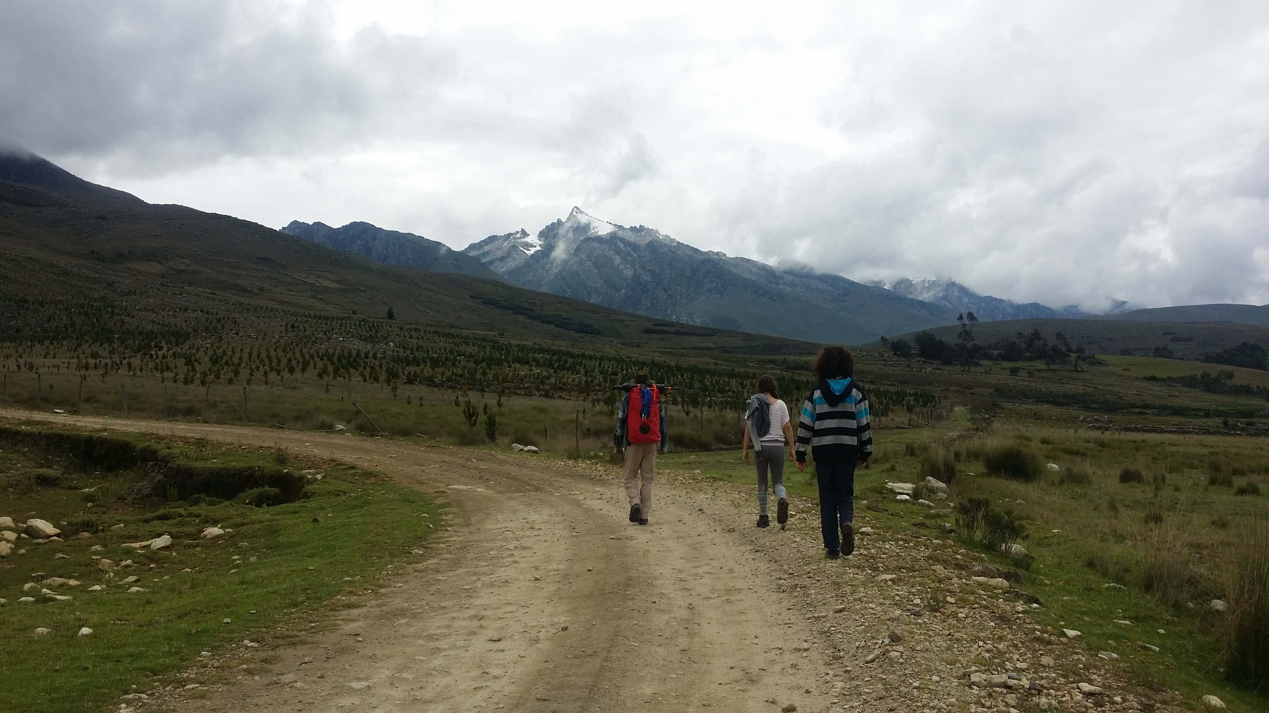
Heading up to Laguna Churup. Photo by V.
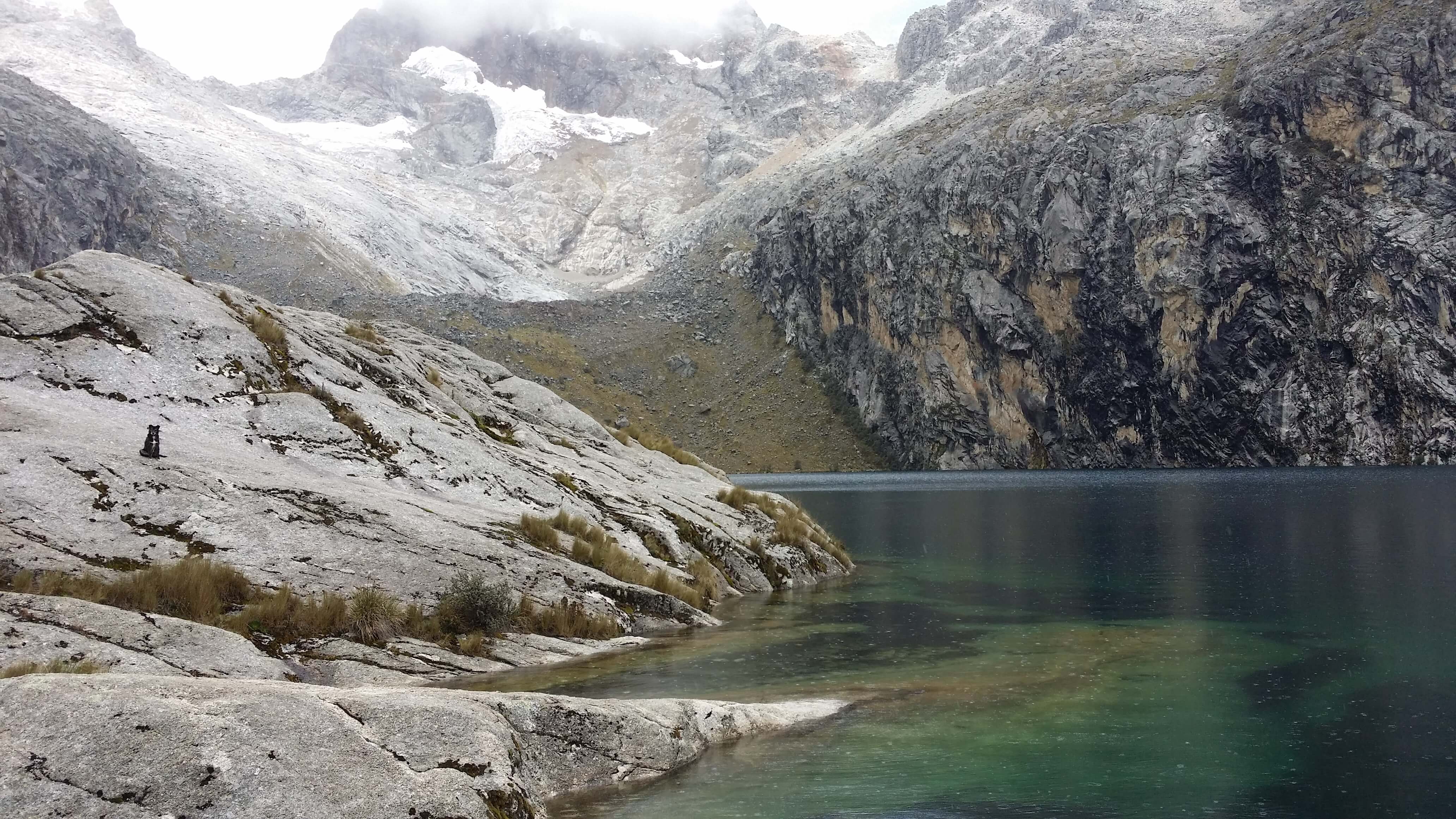
Laguna Churup. Photo by Nate
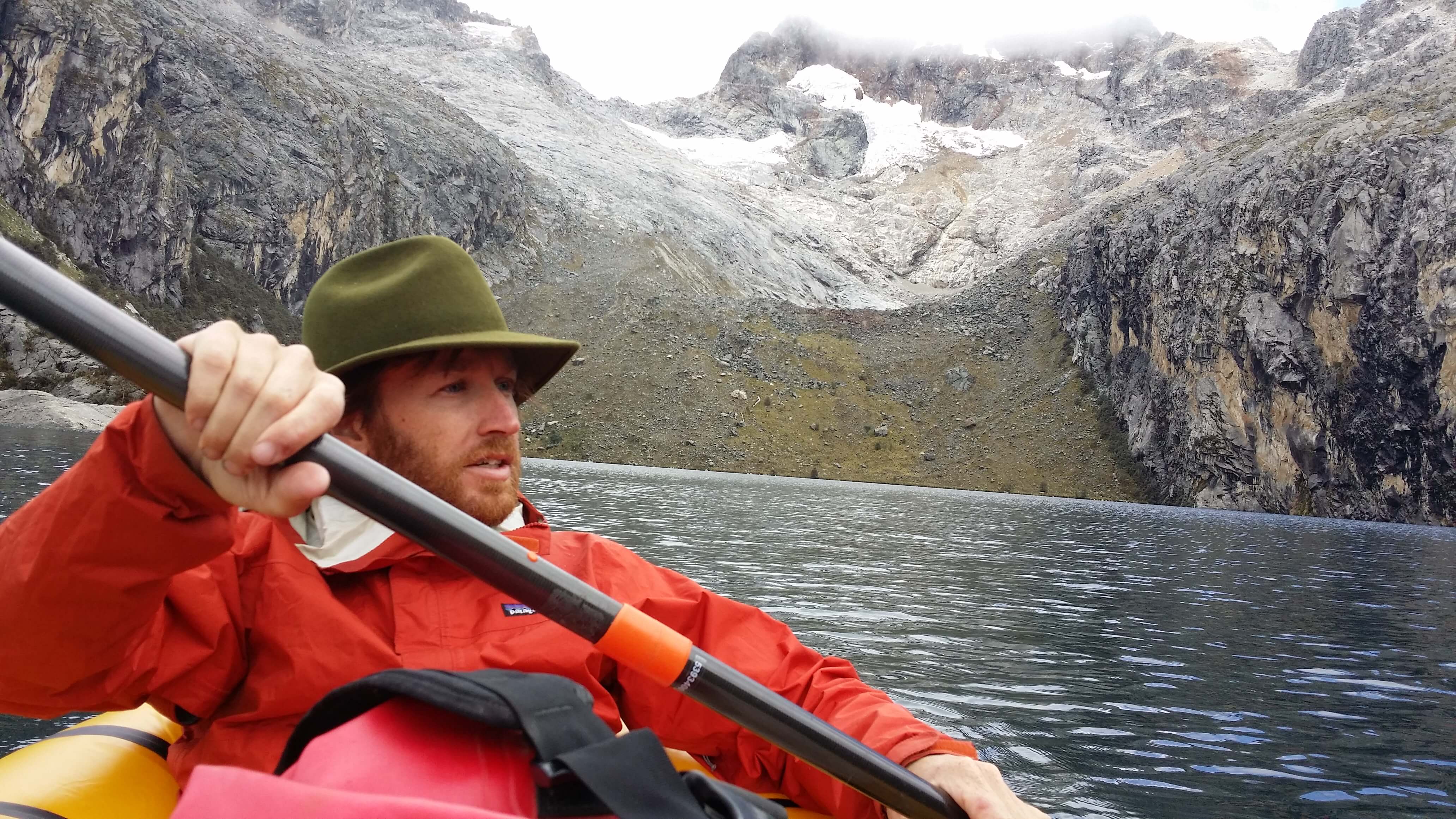
Paddling Laguna Churup. Photo by V.
We came back down to the hostel and to B and A happily reading under piles of blankets. I was very proud of them. First of all, we looked up how high we had been. 4300 meters. That’s 14,100 feet. That’s almost as high as Mt. Rainier. That’s impressive for an 11 and 13-year-old Seattleite. Second, they made the decision to head back to the hostel on their own, following not a trail, but landmarks only. They’re getting older and more responsible. When did that happen?
We left the Huaraz area for a town on the other side of the mountains, but were foiled twice: once by a bridge that was out and once by a storm that rolled in. We hadn’t seen a storm quite like it on this trip. Sheets of rain rolling in. Rain turning to hail. Hail turning into harder rain. Lightning shattering the sky in two. Thunder, not far behind echoing across the valley. How tall is this metal van of ours again? And what’s on the roof rack? That’s right, a propane tank and jerry can full of diesel. Hmmm. A small ravine brings a torrent of water across the road. Well, not really water, more like cinnamon-colored mud and large pebbles. “I’m not driving any further.” I said. “Ok”, said the rest. Consensus.
We turned around and headed to Hatun Machay, a climbing mecca amongst a strange rock “forest” and I’m told there are petroglyphs as well. We finally reached the turn-off and headed up the dirt road only to be stopped at the first curve. It’s deceptively muddy and we’re sliding. It took us 30 minutes to back down the 50 yards without sliding off the road. What to do now? We ended up finding a nice place to camp in the middle of the steppe-like plains. It was the quietest night I’ve witnessed in a long time.
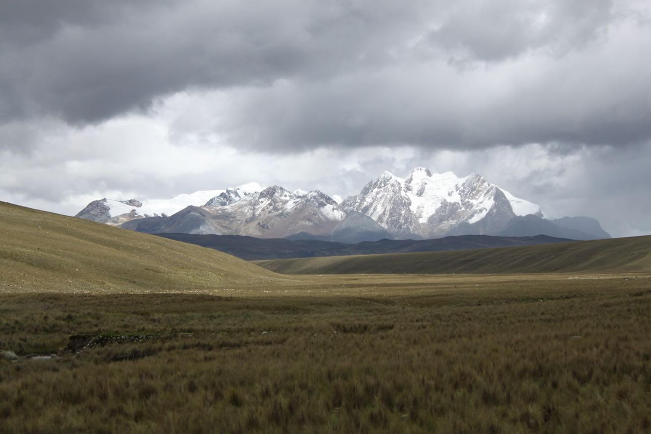
The next morning brought with it sun and a joy that only a day of stormy weather can bring. We decided to try that town on the other side again. We climbed higher and higher over the Cordillera Blanca and down into another valley to our destination, Chavin de Huantar.
Driving over the Cordillera Blanca. Photo by Nate
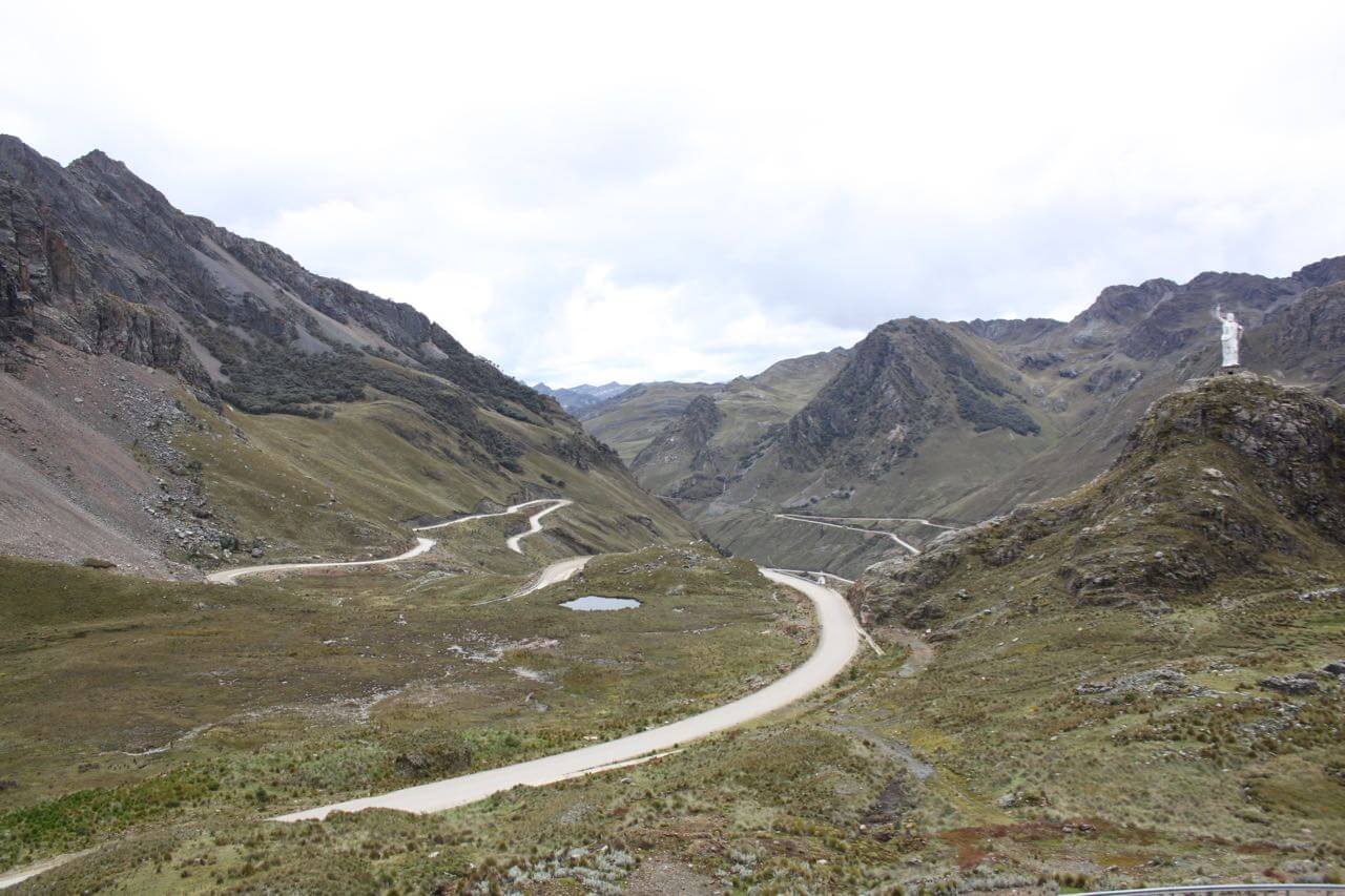
Mountain road to Chavin. Photo by Nate
Chavin de Huantar is a pre-Inca archeological site. The Chavin culture built a series of temples and plazas between 1300 and 400 BC. To put that into perspective for any Euro-minded readers, that’s before the Roman Empire. Way before. This place was a spiritual pilgrimage site for people all around the Andes, the coast, and even up into present-day Ecuador. They would come, give offerings, feast, take hallucinogenic drugs from a cactus and enter a maze of underground passages which leads to a very large, intricately carved stone called the Lance where they would talk to the Divine about things like rain and crops. And who knows, maybe to inquire what they should do with their lives when they grow up.
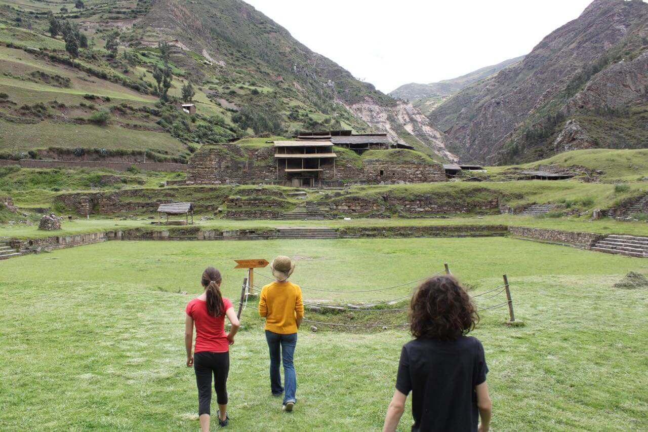
Walking onto the main plaza at Chavin de Huantar. Photo by Nate
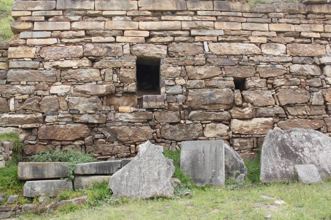
A temple at Chavin de Huantar. Photo by Nate
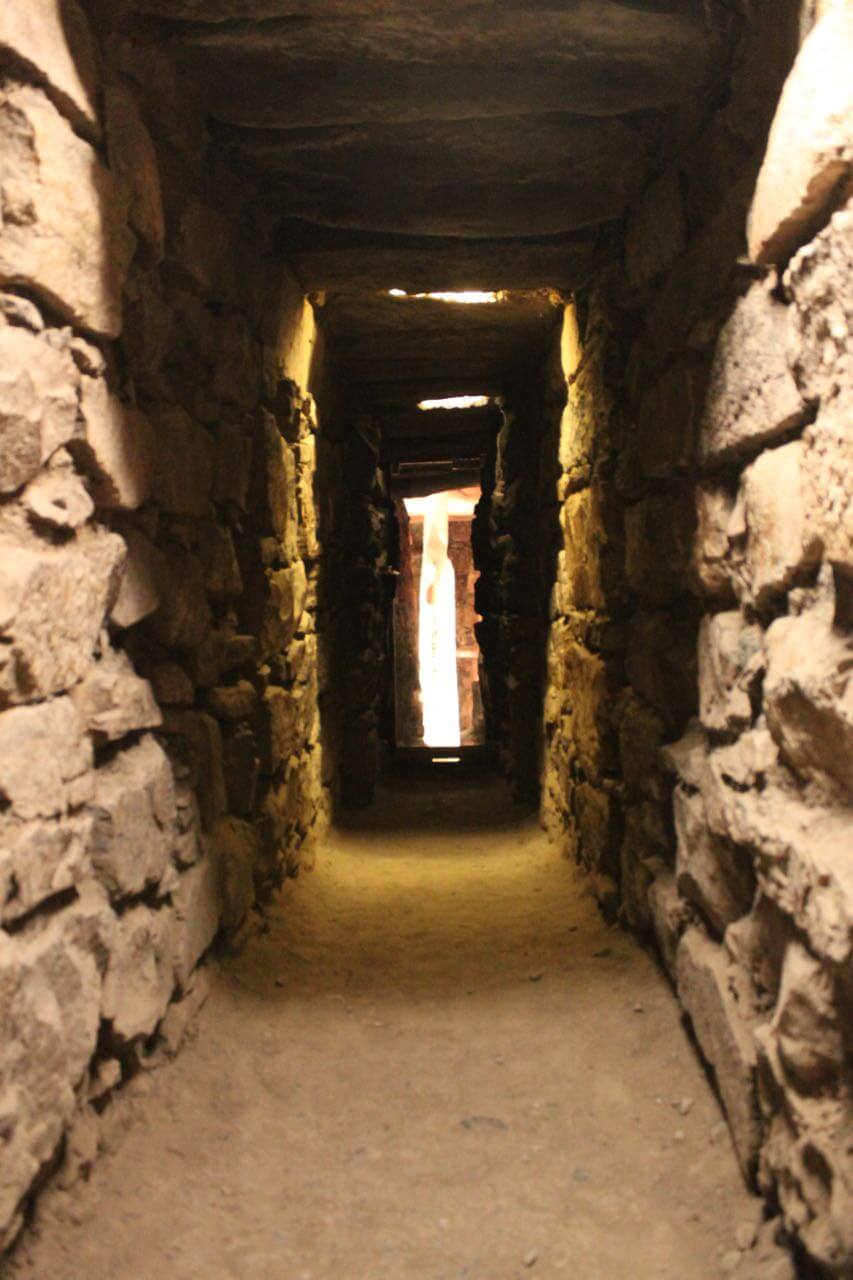
A tunnel leading to the Lance – a sacred stone – in the distance at Chavin de Huantar. Photo by Nate
Funny, we’ve met a few people on this trip who work for or attended ayahuasca retreats and ceremonies. Young and old, rich and poor come from around the world into Peru to drink ayahuasca, talk to shamans, and find… find…? Meaning? God? Health? Rain? Perhaps the Chavin were ahead of their time. Or perhaps the search for meaning, god, health and rain is as old as humanity itself.
Whatever the search is for, the mountains have always seemed to me like a good place to find things. There is a clarity up here I have a hard time finding anywhere else. People speak of the sea as the final resting place. The end. All things lead to the sea, they say. If that’s true, then surely the mountains are the beginning. Here you find the youngest rock and the birthplace of rivers all waiting patiently for age and gravity to take hold. Perhaps a journey to the mountains is somehow a journey to our beginning. A reminder of just what the hell it is we’re doing here anyway. Clarity. I don’t know, maybe they’re just a bunch of rocks.
But our journey, for now, will take us back to the heat, down to the coastal desert and into the hot, confusing, cement and glass landscape of Lima. I’m not really a fan of Lima. There was an incident there 13 years ago. It’s another story, but let’s just say it involved a gun, and an unexpected, unrequested tour of the city in the back of a car. I hope this time will be better, and like last time will finish with a return to the mountains.
The Cordillera Blanca. Photo by Nate


Keep on living the dream for the rest of us!! So fun to see the photos!
Wow!!! It’s so fabulous catching up with you. I still can’t believe how strong & brave you are all. We love you
Nos deben la versión en Español…